| at: |
Lake Chatuge Recreation Area |
Data from USFS GIS
 show on map
 animate
Trail users:

Elevation Profile
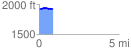
 0.899451 mi
 33.92 ft
 36.84 ft
 -2.92 ft
 0.78 %
GPX Downloads: Track Route
![]()
| at: |
Lake Chatuge Recreation Area |
show on map
animate
0.899451 mi
33.92 ft
36.84 ft
-2.92 ft
0.78 %