| at: |
Gumlog Mountain/Brasstown Bald |
Data from David Muse
 show on map
 animate
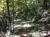
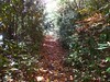
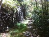
Originally intended to be the continuation of the road that leads up to Brasstown Bald from Hwy 180, this road was never finished and now lies as a hiking trail along Wolfpen Ridge, in the Brasstown Wilderness.
Trail users:
Elevation Profile

 5.669439 mi
 2883.88 ft
 1191.53 ft
 1692.35 ft
 9.63 %
GPX Downloads: Track Route
Trailheads:
 Brasstown Bald Parking Lot