| in: |
Central Florida |
near: |
Ocala,
Florida |
 show on map
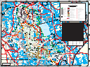
 printable map
Last Trail Update: 2025-09-19
printable map
Last Trail Update: 2025-09-19Maps:
Trailheads:
 Florida Trail Rodman ATV Trailhead
Total Mileage: (note)
 Dirt/Gravel Road - 109.98 mi Unmaintained Road - 3.61 mi
Trails:
NE 230th Avenue Side Trail - 0.31 mi Roads:
Fort Gates Ferry Road - 0.97 mi FS05 - 13.66 mi FS13 - 2.48 mi FS22 - 16.76 mi FS26 - 6.68 mi FS29 - 7.19 mi FS30 - 8.28 mi FS33 - 11.13 mi FS46 - 5.27 mi FS50 - 12.64 mi | AKA: |
Hopkins Prairie Road |
FS61 (Section 2, Unpaved) - 4.19 mi | AKA: |
SE 24th Street |
FS88 (North, Unpaved) - 9.56 mi FS93 - 1.04 mi FS93B - 0.12 mi Maple Drive - 0.05 mi NE 126th Place - 0.21 mi NE 133rd Street - 0.03 mi NE 135th Lane - 0.05 mi NE136 Street - 0.50 mi NE 207 Court - 0.30 mi NE 209 Court (East) - 0.28 mi NE 209 Court (West) - 0.13 mi NE209th Terrace - 0.22 mi NE 212 Terrace - 0.01 mi NE 213 Avenue - 0.19 mi NE 219th Avenue - 0.10 mi NE 228th Court - 0.42 mi Railroad Grade Road - 1.86 mi SE 135th Avenue (Section 1, Unpaved) - 3.24 mi SE 135th Avenue (Section 3, Unpaved) - 1.44 mi SE 149th Court - 0.11 mi Turkey Lane - 0.37 mi Unknown Road - 0.49 mi FS71 - 3.61 mi FS24 - 0.97 mi FS61 (Section 1, Paved) - 0.51 mi | AKA: |
SE 24th Street |
FS61 (Section 3, Paved) - 0.34 mi | AKA: |
SE 24th Street |
FS88 (Paved) - 1.79 mi FS88 (South, Paved) - 4.25 mi Hwy 40 - 34.22 mi Juniper Springs Road - 0.20 mi Mount Royal Road - 0.25 mi Mount Royal Road (Unexplored) - 0.70 mi NE 226th Avenue - 1.30 mi SE 135th Avenue (Section 2, Paved) - 0.51 mi