|
| at: |
LBJ National Grassland |
Data from USFS GIS
 show on map
 animate
Trail users:


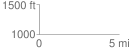
Elevation Profile
 0.039049 mi
 1.65 ft
 0.48 ft
 1.16 ft
 0.80 %
GPX Downloads: Track Route
![]()
|
| at: |
LBJ National Grassland |
show on map
animate
0.039049 mi
1.65 ft
0.48 ft
1.16 ft
0.80 %