| at: |
LBJ National Grassland |
Data from USFS GIS
 show on map
 animate
Trail users:


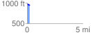
Elevation Profile
 0.246969 mi
 8.01 ft
 29.27 ft
 -21.26 ft
 2.24 %
GPX Downloads: Track Route
![]()
| at: |
LBJ National Grassland |
show on map
animate
0.246969 mi
8.01 ft
29.27 ft
-21.26 ft
2.24 %