|
| at: |
LBJ National Grassland |
Data from USFS GIS
 show on map
 animate
Trail users:


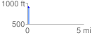
Elevation Profile
 0.192505 mi
 0.56 ft
 19.61 ft
 -19.05 ft
 1.93 %
GPX Downloads: Track Route
![]()
|
| at: |
LBJ National Grassland |
show on map
animate
0.192505 mi
0.56 ft
19.61 ft
-19.05 ft
1.93 %