| at: |
Angelina National Forest |
Data from USFS GIS
 show on map
 animate
Trail users:


Elevation Profile
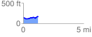
 1.240939 mi
 100.18 ft
 68.92 ft
 31.26 ft
 1.53 %
GPX Downloads: Track Route
![]()
| at: |
Angelina National Forest |
show on map
animate
1.240939 mi
100.18 ft
68.92 ft
31.26 ft
1.53 %