|
| at: |
Angelina National Forest |
Data from USFS GIS
 show on map
 animate
Trail users:


Elevation Profile
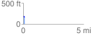
 0.122713 mi
 6.45 ft
 20.13 ft
 -13.67 ft
 3.11 %
GPX Downloads: Track Route
![]()
|
| at: |
Angelina National Forest |
show on map
animate
0.122713 mi
6.45 ft
20.13 ft
-13.67 ft
3.11 %