| at: |
Angelina National Forest |
Data from USFS GIS
 show on map
 animate
Trail users:


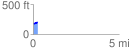
Elevation Profile
 0.259178 mi
 20.55 ft
 2.75 ft
 17.80 ft
 1.50 %
GPX Downloads: Track Route
![]()
| at: |
Angelina National Forest |
show on map
animate
0.259178 mi
20.55 ft
2.75 ft
17.80 ft
1.50 %