| at: |
Angelina National Forest |
Data from USFS GIS
 show on map
 animate
Trail users:


Elevation Profile
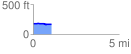
 1.080304 mi
 13.21 ft
 26.33 ft
 -13.12 ft
 0.46 %
GPX Downloads: Track Route
![]()
| at: |
Angelina National Forest |
show on map
animate
1.080304 mi
13.21 ft
26.33 ft
-13.12 ft
0.46 %