| at: |
Stephen F. Austin Experimental Forest |
Data from USFS GIS
 show on map
 animate
Trail users:

Elevation Profile
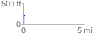
 0.081654 mi
 7.14 ft
 1.43 ft
 5.70 ft
 1.66 %
GPX Downloads: Track Route
![]()
| at: |
Stephen F. Austin Experimental Forest |
show on map
animate
0.081654 mi
7.14 ft
1.43 ft
5.70 ft
1.66 %