| at: |
Davy Crockett National Forest |
Data from USFS GIS
 show on map
 animate
Trail users:


Elevation Profile
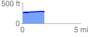
 1.876840 mi
 66.56 ft
 30.37 ft
 36.19 ft
 0.67 %
GPX Downloads: Track Route
![]()
| at: |
Davy Crockett National Forest |
show on map
animate
1.876840 mi
66.56 ft
30.37 ft
36.19 ft
0.67 %