|
| at: |
Sabine National Forest |
Data from USFS GIS
 show on map
 animate
Trail users:


Elevation Profile
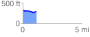
 1.162755 mi
 28.41 ft
 64.08 ft
 -35.67 ft
 1.04 %
GPX Downloads: Track Route
![]()
|
| at: |
Sabine National Forest |
show on map
animate
1.162755 mi
28.41 ft
64.08 ft
-35.67 ft
1.04 %