| at: |
Sabine National Forest |
Data from USFS GIS
 show on map
 animate
Trail users:


Elevation Profile
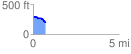
 0.719448 mi
 11.33 ft
 107.08 ft
 -95.75 ft
 2.82 %
GPX Downloads: Track Route
![]()
| at: |
Sabine National Forest |
show on map
animate
0.719448 mi
11.33 ft
107.08 ft
-95.75 ft
2.82 %