|
| at: |
Sabine National Forest |
Data from USFS GIS
 show on map
 animate
Trail users:


Elevation Profile
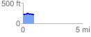
 0.942152 mi
 57.16 ft
 84.81 ft
 -27.65 ft
 1.70 %
GPX Downloads: Track Route
![]()
|
| at: |
Sabine National Forest |
show on map
animate
0.942152 mi
57.16 ft
84.81 ft
-27.65 ft
1.70 %