|
| at: |
Sabine National Forest |
Data from USFS GIS
 show on map
 animate
Trail users:


Elevation Profile
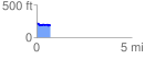
 0.710873 mi
 39.66 ft
 83.45 ft
 -43.79 ft
 2.22 %
GPX Downloads: Track Route
![]()
|
| at: |
Sabine National Forest |
show on map
animate
0.710873 mi
39.66 ft
83.45 ft
-43.79 ft
2.22 %