| at: |
Sabine National Forest |
Data from USFS GIS
 show on map
 animate
Trail users:


Elevation Profile
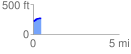
 0.478505 mi
 51.59 ft
 3.99 ft
 47.60 ft
 2.04 %
GPX Downloads: Track Route
![]()
| at: |
Sabine National Forest |
show on map
animate
0.478505 mi
51.59 ft
3.99 ft
47.60 ft
2.04 %