| at: |
Sabine National Forest |
Data from USFS GIS
 show on map
 animate
Trail users:


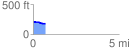
Elevation Profile
 0.713816 mi
 6.14 ft
 41.22 ft
 -35.08 ft
 1.09 %
GPX Downloads: Track Route
![]()
| at: |
Sabine National Forest |
show on map
animate
0.713816 mi
6.14 ft
41.22 ft
-35.08 ft
1.09 %