| at: |
Sabine National Forest |
Data from USFS GIS
 show on map
 animate
Trail users:


Elevation Profile
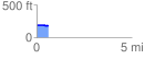
 0.615628 mi
 7.50 ft
 23.45 ft
 -15.95 ft
 0.72 %
GPX Downloads: Track Route
![]()
| at: |
Sabine National Forest |
show on map
animate
0.615628 mi
7.50 ft
23.45 ft
-15.95 ft
0.72 %