|
| at: |
Sam Houston National Forest |
Data from USFS GIS
 show on map
 animate
Trail users:


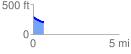
Elevation Profile
 0.600715 mi
 9.36 ft
 89.33 ft
 -79.96 ft
 2.82 %
GPX Downloads: Track Route
![]()
|
| at: |
Sam Houston National Forest |
show on map
animate
0.600715 mi
9.36 ft
89.33 ft
-79.96 ft
2.82 %