| at: |
Sam Houston National Forest |
Data from USFS GIS
 show on map
 animate
Trail users:


Elevation Profile
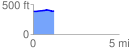
 1.249102 mi
 35.39 ft
 26.06 ft
 9.34 ft
 0.54 %
GPX Downloads: Track Route
![]()
| at: |
Sam Houston National Forest |
show on map
animate
1.249102 mi
35.39 ft
26.06 ft
9.34 ft
0.54 %