| at: |
Sam Houston National Forest |
Data from USFS GIS
 show on map
 animate
Trail users:


Elevation Profile
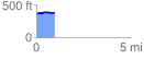
 0.983701 mi
 34.02 ft
 22.06 ft
 11.96 ft
 0.66 %
GPX Downloads: Track Route
![]()
| at: |
Sam Houston National Forest |
show on map
animate
0.983701 mi
34.02 ft
22.06 ft
11.96 ft
0.66 %