|
| at: |
Forks Area Trail System Sumter National Forest - Long Cane District |
Data from USFS GIS
 show on map
 animate
Trail users:


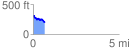
Elevation Profile
 0.687379 mi
 42.76 ft
 157.75 ft
 -114.99 ft
 4.35 %
GPX Downloads: Track Route