| at: |
Sumter National Forest - Long Cane District |
Data from USFS GIS
 show on map
 animate
Trail users:


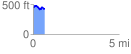
Elevation Profile
 0.692698 mi
 77.23 ft
 93.66 ft
 -16.43 ft
 2.56 %
GPX Downloads: Track Route
![]()
| at: |
Sumter National Forest - Long Cane District |
show on map
animate
0.692698 mi
77.23 ft
93.66 ft
-16.43 ft
2.56 %