| at: |
Sumter National Forest - Long Cane District |
Data from USFS GIS
 show on map
 animate
Trail users:


Elevation Profile
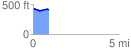
 0.929435 mi
 28.09 ft
 44.71 ft
 -16.62 ft
 0.91 %
GPX Downloads: Track Route
![]()
| at: |
Sumter National Forest - Long Cane District |
show on map
animate
0.929435 mi
28.09 ft
44.71 ft
-16.62 ft
0.91 %