| at: |
Sumter National Forest - Long Cane District |
Data from USFS GIS
 show on map
 animate
Trail users:


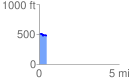
Elevation Profile
 0.457412 mi
 16.14 ft
 48.94 ft
 -32.81 ft
 2.03 %
GPX Downloads: Track Route
![]()
| at: |
Sumter National Forest - Long Cane District |
show on map
animate
0.457412 mi
16.14 ft
48.94 ft
-32.81 ft
2.03 %