| at: |
Sumter National Forest - Long Cane District |
Data from USFS GIS
 show on map
 animate
Trail users:


Elevation Profile
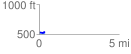
 0.357646 mi
 14.95 ft
 8.65 ft
 6.30 ft
 0.79 %
GPX Downloads: Track Route
![]()
| at: |
Sumter National Forest - Long Cane District |
show on map
animate
0.357646 mi
14.95 ft
8.65 ft
6.30 ft
0.79 %