| at: |
Talladega National Forest |
Data from USFS GIS
 show on map
 animate
Trail users:

Elevation Profile
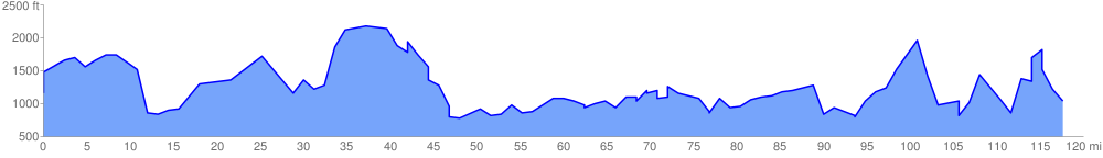
 120.043310 mi
 46074.18 ft
 46449.08 ft
 -374.90 ft
 7.33 %
GPX Downloads: Track Route
![]()
| at: |
Talladega National Forest |
show on map
animate
120.043310 mi
46074.18 ft
46449.08 ft
-374.90 ft
7.33 %