|
| at: |
Bankhead National Forest |
Data from USFS GIS
 show on map
 animate
Trail users:


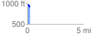
Elevation Profile
 0.236512 mi
 40.30 ft
 67.68 ft
 -27.38 ft
 5.42 %
GPX Downloads: Track Route
![]()
|
| at: |
Bankhead National Forest |
show on map
animate
0.236512 mi
40.30 ft
67.68 ft
-27.38 ft
5.42 %