|
| at: |
Talladega National Forest |
Data from USFS GIS
 show on map
 animate
Trail users:


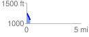
Elevation Profile
 0.335560 mi
 33.78 ft
 161.81 ft
 -128.02 ft
 9.13 %
GPX Downloads: Track Route
![]()
|
| at: |
Talladega National Forest |
show on map
animate
0.335560 mi
33.78 ft
161.81 ft
-128.02 ft
9.13 %