|
| at: |
Talladega National Forest |
Data from USFS GIS
 show on map
 animate
Trail users:


Elevation Profile
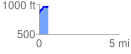
 0.572448 mi
 139.37 ft
 14.00 ft
 125.37 ft
 4.61 %
GPX Downloads: Track Route
![]()
|
| at: |
Talladega National Forest |
show on map
animate
0.572448 mi
139.37 ft
14.00 ft
125.37 ft
4.61 %