|
| at: |
Talladega National Forest |
Data from USFS GIS
 show on map
 animate
Trail users:


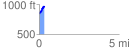
Elevation Profile
 0.328686 mi
 126.98 ft
 17.70 ft
 109.28 ft
 7.32 %
GPX Downloads: Track Route
![]()
|
| at: |
Talladega National Forest |
show on map
animate
0.328686 mi
126.98 ft
17.70 ft
109.28 ft
7.32 %