| at: |
Camp Wahsega |
Data from David Muse
 show on map
 animate
Trail users:

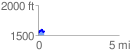
Elevation Profile
 0.406597 mi
 84.22 ft
 64.56 ft
 19.66 ft
 3.92 %
GPX Downloads: Track Route
![]()
| at: |
Camp Wahsega |
show on map
animate
0.406597 mi
84.22 ft
64.56 ft
19.66 ft
3.92 %