|
| at: |
Talladega National Forest |
Data from USFS GIS
 show on map
 animate
Trail users:


Elevation Profile
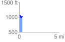
 0.392788 mi
 105.59 ft
 146.12 ft
 -40.53 ft
 7.05 %
GPX Downloads: Track Route
![]()
|
| at: |
Talladega National Forest |
show on map
animate
0.392788 mi
105.59 ft
146.12 ft
-40.53 ft
7.05 %