|
| at: |
Talladega National Forest |
Data from USFS GIS
 show on map
 animate
Trail users:


Elevation Profile
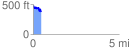
 0.453533 mi
 59.83 ft
 168.94 ft
 -109.12 ft
 7.05 %
GPX Downloads: Track Route
![]()
|
| at: |
Talladega National Forest |
show on map
animate
0.453533 mi
59.83 ft
168.94 ft
-109.12 ft
7.05 %