|
| at: |
Talladega National Forest |
Data from USFS GIS
 show on map
 animate
Trail users:


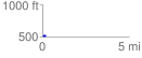
Elevation Profile
 0.197364 mi
 14.20 ft
 13.66 ft
 0.54 ft
 1.36 %
GPX Downloads: Track Route
![]()
|
| at: |
Talladega National Forest |
show on map
animate
0.197364 mi
14.20 ft
13.66 ft
0.54 ft
1.36 %