|
| at: |
Talladega National Forest |
Data from USFS GIS
 show on map
 animate
Trail users:


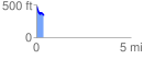
Elevation Profile
 0.380255 mi
 20.25 ft
 168.07 ft
 -147.82 ft
 8.37 %
GPX Downloads: Track Route
![]()
|
| at: |
Talladega National Forest |
show on map
animate
0.380255 mi
20.25 ft
168.07 ft
-147.82 ft
8.37 %