| at: |
Leita Thompson Memorial Park |
Data from David Muse
 show on map
 animate
Trail users:

Elevation Profile
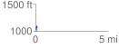
 0.110506 mi
 54.21 ft
 0.00 ft
 54.21 ft
 9.29 %
GPX Downloads: Track Route
![]()
| at: |
Leita Thompson Memorial Park |
show on map
animate
0.110506 mi
54.21 ft
0.00 ft
54.21 ft
9.29 %