| at: |
Ocala National Forest |
Data from Karlos Bernart
 show on map
 animate
Trail users:


Elevation Profile
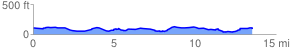
 13.662453 mi
 457.67 ft
 479.49 ft
 -21.83 ft
 0.66 %
GPX Downloads: Track Route
![]()
| at: |
Ocala National Forest |
show on map
animate
13.662453 mi
457.67 ft
479.49 ft
-21.83 ft
0.66 %