| at: |
Fort Yargo |
Data from David Muse
 show on map
 animate
Trail users:


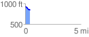
Elevation Profile
 0.444011 mi
 8.88 ft
 84.24 ft
 -75.36 ft
 3.59 %
GPX Downloads: Track Route
![]()
| at: |
Fort Yargo |
show on map
animate
0.444011 mi
8.88 ft
84.24 ft
-75.36 ft
3.59 %