| at: |
Paulding Forest |
Data from David Muse
 show on map
 animate
Trail users:

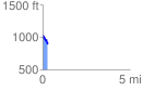
Elevation Profile
 0.297596 mi
 2.36 ft
 149.12 ft
 -146.76 ft
 9.49 %
GPX Downloads: Track Route
![]()
| at: |
Paulding Forest |
show on map
animate
0.297596 mi
2.36 ft
149.12 ft
-146.76 ft
9.49 %