| at: |
Paulding Forest |
Data from Georgia DOT
 show on map
 animate
Trail users:


Elevation Profile
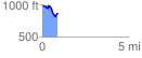
 0.878969 mi
 103.67 ft
 221.47 ft
 -117.80 ft
 4.77 %
GPX Downloads: Track Route
![]()
| at: |
Paulding Forest |
show on map
animate
0.878969 mi
103.67 ft
221.47 ft
-117.80 ft
4.77 %