| at: |
Tombigbee National Forest - South |
Data from USFS GIS
 show on map
 animate
Trail users:


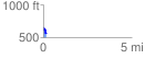
Elevation Profile
 0.157650 mi
 39.43 ft
 109.29 ft
 -69.86 ft
 13.13 %
GPX Downloads: Track Route
![]()
| at: |
Tombigbee National Forest - South |
show on map
animate
0.157650 mi
39.43 ft
109.29 ft
-69.86 ft
13.13 %