| at: |
Tombigbee National Forest - North |
Data from USFS GIS
 show on map
 animate
Trail users:


Elevation Profile
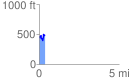
 0.359479 mi
 114.50 ft
 94.79 ft
 19.71 ft
 6.03 %
GPX Downloads: Track Route
![]()
| at: |
Tombigbee National Forest - North |
show on map
animate
0.359479 mi
114.50 ft
94.79 ft
19.71 ft
6.03 %