| at: |
Tombigbee National Forest - North |
Data from USFS GIS
 show on map
 animate
Trail users:


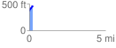
Elevation Profile
 0.242323 mi
 116.61 ft
 42.57 ft
 74.05 ft
 9.11 %
GPX Downloads: Track Route
![]()
| at: |
Tombigbee National Forest - North |
show on map
animate
0.242323 mi
116.61 ft
42.57 ft
74.05 ft
9.11 %