| at: |
Holly Springs National Forest - North |
Data from USFS GIS
 show on map
 animate
Trail users:


Elevation Profile
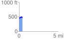
 0.414269 mi
 87.50 ft
 66.16 ft
 21.34 ft
 4.00 %
GPX Downloads: Track Route
![]()
| at: |
Holly Springs National Forest - North |
show on map
animate
0.414269 mi
87.50 ft
66.16 ft
21.34 ft
4.00 %