| at: |
Holly Springs National Forest - North |
Data from USFS GIS
 show on map
 animate
Trail users:


Elevation Profile
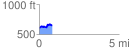
 0.803155 mi
 137.05 ft
 93.74 ft
 43.31 ft
 3.23 %
GPX Downloads: Track Route
![]()
| at: |
Holly Springs National Forest - North |
show on map
animate
0.803155 mi
137.05 ft
93.74 ft
43.31 ft
3.23 %