|
| at: |
Bienville National Forest |
Data from USFS GIS
 show on map
 animate
Trail users:


Elevation Profile
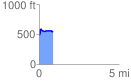
 0.854613 mi
 120.57 ft
 67.10 ft
 53.46 ft
 2.67 %
GPX Downloads: Track Route
![]()
|
| at: |
Bienville National Forest |
show on map
animate
0.854613 mi
120.57 ft
67.10 ft
53.46 ft
2.67 %