|
| at: |
Bienville National Forest |
Data from USFS GIS
 show on map
 animate
Trail users:


Elevation Profile
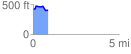
 0.894726 mi
 72.44 ft
 85.14 ft
 -12.71 ft
 1.80 %
GPX Downloads: Track Route
![]()
|
| at: |
Bienville National Forest |
show on map
animate
0.894726 mi
72.44 ft
85.14 ft
-12.71 ft
1.80 %