|
| at: |
Bienville National Forest |
Data from USFS GIS
 show on map
 animate
Trail users:


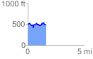
Elevation Profile
 1.629354 mi
 235.34 ft
 236.70 ft
 -1.36 ft
 2.75 %
GPX Downloads: Track Route
![]()
|
| at: |
Bienville National Forest |
show on map
animate
1.629354 mi
235.34 ft
236.70 ft
-1.36 ft
2.75 %